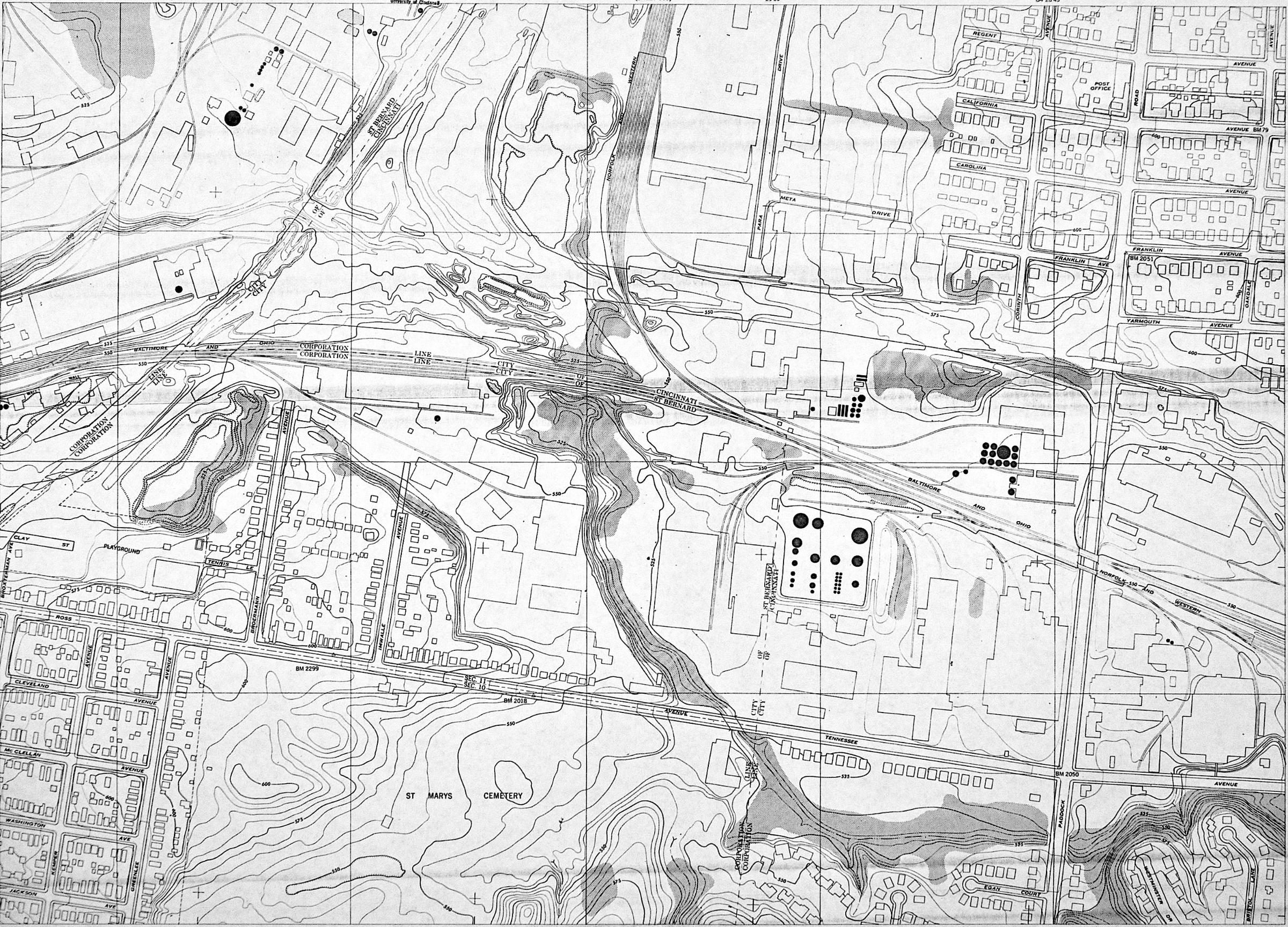
1948 USGS map showing the at-grade subway route in St. Bernard and Bond Hill. The canal followed the Cincinnati/St. Bernard corporation line at the top left, and I-75 is just to the east of that line today. The subway route follwed the canal until crossing the B&O railroad line, then in turned to the east to go under the N&W, crossing Paddock Road south of Yarmouth Avenue. The Norwood Lateral follows this route exactly.